
Shamal Technologies Logo
Agriculture Monitoring
Service

Agriculture Monitoring

Every block, not a sample walk

Plantation and crop intelligence from LiDAR, multispectral, and soil-moisture sensing — canopy change, plant stress, and wet or dry zones mapped at field scale.

Overview

Growth and water, mapped before the stress shows

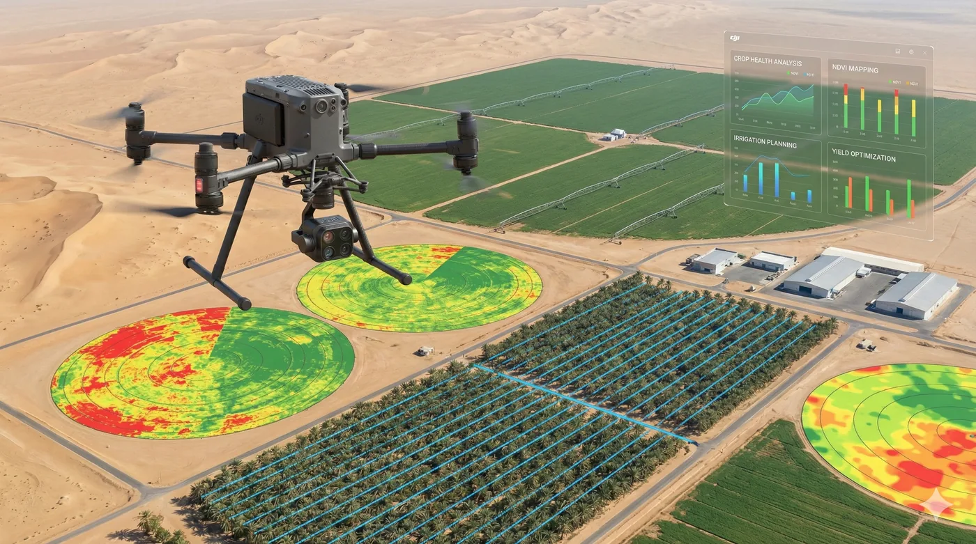
A walk through a plantation cannot track individual canopy change or find dry and over-saturated ground until the crop already shows it. Shamal flies repeat LiDAR to build canopy height models, multispectral passes for indices such as NDVI, and soil-moisture sensing to flag zones that need a different water regime.

Deliverables are made for the agronomy team: classified point clouds, canopy models, NDVI GeoTIFFs, and moisture heat maps, georeferenced so a finding can be walked to.

Benefits

Service Benefits

What you gain when Shamal plans, flies, and delivers the work

Canopy change you can measure
Repeat LiDAR point clouds and canopy height models show growth between dates, tree by tree at field scale.
Stress before it is visible
Multispectral indices reveal plant condition that a visual walk will only confirm later.
Water where it is wrong
Soil-moisture maps flag dry and over-saturated zones for irrigation decisions.
Field-scale, not a sample
Repeatable coverage of plantation blocks in a single planned mission.
Georeferenced for the crew
Findings land on a map the field team can navigate to, not in a general report.
A season you can compare
The same flight and processing path so this cycle is measured against the last.
Use Cases

Applications

Where this service is applied across projects in Saudi Arabia

Palm and plantation health
Canopy structure and change tracked across blocks that cannot be inspected tree by tree on foot.
Crop stress mapping
NDVI and multispectral orthomosaics for early variation in plant condition.
Irrigation diagnostics
Moisture heat maps that separate dry ground from over-watered ground.
Growth monitoring
Repeat canopy height models for programmes that need a measured growth record.
Large agricultural holdings
Coverage planned in repeatable blocks so a holding is monitored to one specification.
Environmental vegetation checks
The same multispectral method applied where planted or natural vegetation must be reported.
Technology

Technologies Used

Aircraft, sensors, and processing methods behind the deliverable

Survey-grade LiDAR
Repeat point clouds in LAS/LAZ for canopy structure and height models.
Canopy height models
A comparable surface of the crop between flight dates.
Multispectral NDVI
Five-band imagery processed into a health map and a matching RGB orthophoto.
Soil-moisture sensing
Georeferenced moisture heat maps for dry and over-saturated zones.
Enterprise multirotor capture
Stable, low-altitude flights suited to plantation blocks and field resolution.
GeoTIFF delivery
Index and moisture maps issued for agronomy software and GIS.
FAQ

Frequently Asked Questions

Practical answers on scope, outputs, and how a project starts

Get Started
Plan a field monitoring cycle
Tell us the crop, the area, and whether the question is growth, stress, or water. We will match the payload and the map.